Wednesday, May 13, 2009

From the Blackhills to the Badlands to Boston

After leaving the Little Big Horn Battlefield area, we stopped in Spearfish, SD for the night which is just at the edge of the Blackhills of South Dakota. One of the towns in the area I wanted to visit was Deadwood. Custer had some impact on this town as it was members of his troops who discovered gold in the area which eventually led to the rise of Deadwood, the influx of white miners into the Blackhills and the elimination of the local Indians.
I loved the HBO series called Deadwood which also has been eliminated.
Besides gold, Deadwood is famous for being the place where Wild Bill Hickok was murdered by Jack McCall. Wild Bill was playing poker and holding Aces and Eights when he was shot in the back (of the head). As Deadwood was a territory at the time and there was no real law, a quick trial ensued. McCall was acquited claiming revenge for the death of a brother. The verdict was later overturned and he was eventually hanged for the murder. Calamity Jane is buried next to Wild Bill.

Next on the Badlands tour was the Crazy Horse Memorial near Custer, SD. This is mammoth rock sculpture of Crazy Horse on a horse pointing to his land/people. It has a long way to go to be completed. The work began more than 60 years ago by Korczak Ziolkowski who was from Boston. The face was completed in 1998.


As there is no known photo of Crazy Horse, the image is meant to represent all Indian Warriors. He will be pointing to the land of his people. When asked "where is your land?", Crazy Horse said "my land is where my dead lie buried." The image on the left is the model and the right shows the progress. I don't think I'll live to see it completed.

Not far from Crazy Horse is Mount Rushmore, another place I've always wanted to see. It is pretty impressive but smaller than one might expect. In fact, all of the presidents can fit into Crazy Horse's hair on the Crazy Horse Memorial. Maybe we can add another head someday.

Next we headed for Wall SD for lunch, which gets its notoriety from Wall Drug, a 4 square block, one story emporium. Picture all the tourist shops from any tourist town all crammed into one building. Seems to be a destination spot for some people. I don't get it. But it is near Badlands National Park, so we took the Badlands loop road to get one last use of our lifetime, senior National Park pass. What a surprise. This place was amazing. The landscape really was from another world. The area had been a sea, then a jungle then a desert. Very little vegitation and rock formations that looked like dripping sand castles. Even though we had a 6 hour ride to Sioux Falls ahead of us, we kept stopping at each overlook. Here are a couple of shots.


Then there is the obligatory rainbow shot. This one is a double. You can just see the colors of a second rainbow to the right.

Well, folks, that will about do it for this particular tour. By the time some of you read this we will be home. The whole 3+ months has been an unbelievable time for us and I'm glad some of you didn't mind me sharing it with you. I was reluctant to do a blog, but I got into it and enjoyed it myself. I look at it like a reverse answering machine, you can get messages from me without having to actually talk to me. See you all soon. By the way, I will have a showing of any paintings I did from this trip in a gallery in Norwood in October. I'll keep you all posted.

Sunday, May 10, 2009

Little Big Horn Battlefield National Park

Today's history lesson concerns the Little Big Horn Battle, formerly know as Custer's Last Stand. The lesson started when we saw a sign for the Little Big Horn Battlefield Trading Post with logos for Exxon and KFC. Judy said, "I didn't know Colonel Sanders was at the battle of Little Big Horn." We needed to brush up a bit on our history.
I love these things where one never really knows what happened like the Alamo, Little Big Horn, the 17 minute gap in the Watergate tape. I prefer to just go with the myth or legend. But archeologists have done a lot of work in identifying what troops were in what location and how the battle evolved. For example, they can tell from shell casings they found whether they were Indian of soldier shells, whether the soldiers were in an organized line or chaotic retreat and they can associate casings with a particular rifle to know where a soldier travelled on the battle field. It is really fascinating what they are discovering. A good book that includes a lot of the forensic analysis of the battle is "Son of the Morning Star" by Evan S. Connell. A bit dry but fascinating.


I've always wanted to visit this place and try to relive the battle. We bought an auto-tour cd at the visitor center which was really worth it. The park is laid out pretty well with a loop that brings you to where Reno made the initial attack to where Reno and Benteen tried to find Custer and finally to "Custer Hill" where 200+ members of the 7th Cavalry met their demise. It is pretty desolate but there are many hills and "coulees", which I think are like drainage gulches, that led to the Little Big Horn river. You can see that a lot of the action would have been hidden from view because of the rolling terrain.


Here are a few photos of key areas in the area.

This is the view of the Little Big Horn river from a knoll on the battlefield. The Indian camp would have been just beyond the trees. Custer had sent General Reno to attack the Indian encampment. Reno's men were repulsed and this is the view that he would have had as the Indians attacked and attacked his retreating troops. Those are the Big Horn mountains way off in the distance.

This pictures shows the markers where soldiers fell when trying to rejoin Custer and the remaining troops on what is now Custer Hill. You can see the monument in the top left. Custer had split up his troops and a group of them were trying to regroup, but to no avail. Some made it to join Custer, but, you know the rest of the story...PS, I love the Big Sky you get in the west.


In the 90's, the park was renamed from Custer's Battlefield to Little Big Horn Battlefield and a memorial was set up to honor the native Americans who died in the battle. They were just trying to defend their way of life. I guess they didn't get the memo about Manifest Destiny. It is a beautiful monument. There are names of all the Indians who are known to have died there. They are listed by the tribe they belonged to along with Indian drawings of parts of the battle.

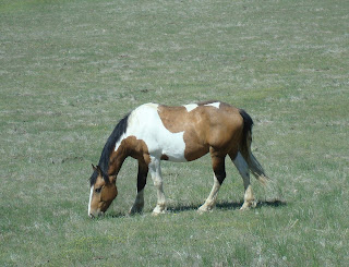
The national park is in the Crow Reservation and there are some horse ranches interspersed throughout the battlefield. It is really cool to see the horses grazing freely throughout the park.

Also, the place was very quiet, partly because there weren't many people there. The only sound we could hear came from a variety of song birds. There were no trees to be found but the birds were hidden in the long grass so we couldn't see where the sounds came from.

I really enjoyed this stop on our return home.

For more information on the Little Big Horn Battlefied, click here

Saturday, May 9, 2009

Lewis and Clark Trail

When we left Yellowstone Park, I found myself driving north then west. This didn't seem like the right direction to get home. But, we were trying to experience a little bit of the Lewis and Clark Expedition. I've always been amazed at the courage and determination it took to venture into an unknown land with very little knowledge of where one was heading. However, we did feel a bit like Lewis and Clark as we weren't sure where we were heading or where we would find food. We were starving, hadn't eaten in a couple of hours, and had no idea where the nearest MacDonald's was. And yet, we persevered and did what any good explorer and adventurer would do to find food, we settled on Pizza Hut.

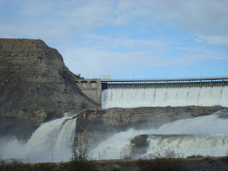
So, we visited a few places along their route. First, Great Falls, Mt is a place of importance for them. They were following the Missouri and had to take a few forks in the road so they weren't always sure they were on the right path. But when then hit the falls, which the Indians had told them about, they knew they had taken the correct course. What they didn't count on was 5 sets of falls that forced an 18 mile portage of all their boats and gear. Here are a couple of shots of falls (there are dams there now but they have kept the integrity of the falls)


.
The next spot we stopped at was Three Forks where we find the headwaters of the Missouri. In the photo at the right, the Madison River is on my right, the Jefferson River is behind me to form the Missouri on my left. They named the rivers, which previously had not been named, after the president and secretary of state. There wasn't much there but it was still great to stand in that spot

The last stop on this Lewis and Clark 101 tour is a place called Pompey's Pillar. It is a large rock formation along the Yellowstone River which Clark spotted on the return trip and named it after Sacagawea's son, Jean Baptiste Charboneau. Clark had nicknamed him Pomp which might be Shoshone for "little chief". This is the only spot on Lewis and Clark trail that has existing physical evidence of their presence at the spot. Clark carved his name into the rock with the date. See below, left.


OK, that concludes the lecture portion of this blog. But a great book on the subject is Undaunted Courage by Stephen Ambrose. Some of you may have read it. I know Kim has.

Friday, May 8, 2009

Yellowstone National Park

Although the weather has been pretty poor here, Yellowstone park is really outstanding. Some of the main roads are still closed and most of the roads leading to trails are closed due to snow. At the high elevations there are several feet of snow. At the lower elevations, there is very little snow. We experieneced all kinds of weather. Here are just a few photos of what one can see here.

Objects in Mirror are Closer than they appear! A little rain can bring some beautiful scenery. These thermal hot spots are all over the park. This is "Roaring Mountain". Bison grazing in the snow... How about a herd of elk grazing? Looks like they were planted there.

Did you know there was a "Grand Canyon" of Yellowstone? These are the falls. So, we are at the ranger station at Old Faithful, and the next eruption is going to be at 4:11, give or take 10 minutes. So, at 4:10, I started my video and this is what I got. BTW, it was blowing snow and we were freezing. Too bad the sky was the same color as Old Faithful.

Wednesday, May 6, 2009

Re-Surfacing

Well, it was a busy last week with packing, cleaning and trying to get a few more paintings off the ground. So, I haven't been too good at the blogging. . Anyway, we took one last off-road adventure with Bill and Sarah to one of our favorite loops through cattle ranches, up into some little canyons near Sycamore Canyon and back over to the Red Rocks near the Hunanki ruins. It was a great day and I took many photos of things I had already photograhed. Just so many photo-ops. We finally got to see a reasonable sized snake in our travels. We think it is a gopher snake and Judy saw a few Javelinas before we left Sedona on Monday morning. We left Northview Rd at 7:45 with a destination of Moab, Utah. We wanted to explore Arches National Park and do some more Jeep'N before settling down. We arrived in time to spend a number of hours touring the park and visiting some of the many natural arches. What incredible scenery.

The next day, we took the Jeep over the Gemini Bridges trail. This was a relatively easy trail but we took a few side trips to play a bit on the slick rock. Remebering I had about 3000 miles to cover, I didn't do anything drastic, just a little fun. Here is a photo of the Gmeini Bridges. From there we stopped at a few interesting sites in Canyonlands National Park before taking the Shafer Rd trail back to Moab. Here is the Mesa Arch in Canyonlands NP. The trip down from the very top of the mesa was pretty scary. The swithbacks were very tight and VERY steep. It was the most nervous I had been on any trail, but once through that first 30 minutes of terror, the scenery was absolutely breath-taking. Here is brief video of the landscape after dropping down from the top of Shafer Rd.

We tried to get up early to head for Yellowstone today. It was a long drive. We crossed Utah from south to north, then a bit of Idaho, Wyoming and stopped in Montana. We passed through parts of Yellowstone on our way to our lodging in Gardiner, Montana. Parts of the park are still closed. I never thought of that. The bad news is we can't go all over the park, the good news is that there are very few people here. We almost have it to ourselves. Have seen lots of wild life already and some beautiful rainbows. This is the first thing we saw upon entering the park. Then this guy appeared. There are elk and bison everywhere.